- First Mineral Map from Opportunity
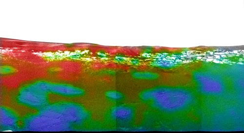
- The Mini-TES instrument on board the Mars Exploration Rover 'Opportunity' has captured a hematite map of the crater the rover is currently in:

The rover's bounce marks and the rock outcropping around the rim of the crater appear low in hematite (colored in blues and greens), while other areas appear much more hematite-rich (colored in red and orange).
Image credit: NASA/JPL/Arizona State University/Cornell University
- First Mini-TES data from Mars
- The first Mini-TES data has now been transmitted to Earth and calibrated. It will now be used to help determine Spirit's first destinations once it leaves its platform. Two images have been released (click on the image for a larger
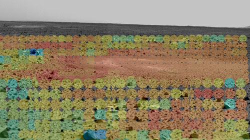
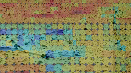
view of each). These images show the Martian terrain through the eyes of the Mini-TES instrument. The different colored circles show a range of soil and rock temperatures, with red representing warmer regions and blue, cooler. Scientists and engineers will use this data to pinpoint features of interest, and to plot a safe course for the rover free of hazy dust. The mini-thermal emission spectrometer data has been superimposed on images taken by the rover's panoramic camera.

The warm and dusty depression dubbed Sleepy Hollow stands out in the upper left.
Image credit: NASA/JPL/Arizona State University/Cornell University

Clusters of cool rocks can be seen to the left and center.
Image credit: NASA/JPL/Arizona State University/Cornell University


